
I am a Harley Davidson Road Captain (RC). Achieving this designation involves a lot of training and demonstrating that you have both riding skills and knowledge of organizing and leading rides. RCs are responsible for coming up with ride destinations and ideas for activities that appeal to motorcycle riders.
In this case, I can’t claim the original idea for the “Five Corners and a Curve” ride. This is a fun idea that explores the perimeter of the border of Nebraska. The curve is the northeast corner of the state, defined by the Missouri River, then 5 corners, defined by the town closest to that corner. The ride been held many times before, but was forgotten for a few years. In a meeting, the Head RC asked if anyone would take over this ride. I raised my hand.
A good RC will have have mapped out each stop. This means not only knowing when to stop, but where to buy gas, who has premium fuel AND ample restrooms for a group. So, I rode the 3 day, 1400 mile route twice in advance. I had the route planned, fuel stops, lunch stops, motels and the timelines for each all done well in advance. This ride would be done on the 3 day Memorial Day weekend, the official beginning of summer. This is the time honored tradition of coming back to work with a sunburn. Well, no one told the official Weather Goddess that it was supposed to be hot and sunny.
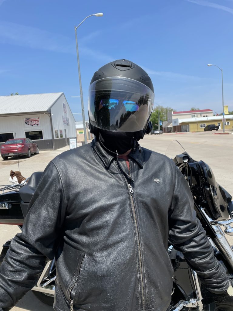
Our small rider group gathered at Frontier Harley at 7am Saturday morning. It was 43 degrees and dry. Pre-ride briefing done, we mounted up and left on schedule at 7:30. Did I mention it was cold? My little Harley Soft Tail Deluxe doesn’t have any fairings, she is designed for fair weather. I have to make up her shortcomings with gear.
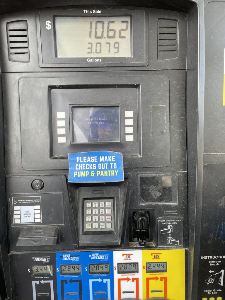
At the first gas stop, we are informed that we are in rural Nebraska. We are an extremely honest and respectful bunch. You might think you are in Mayberry when greeted by the sign that informs you that not only are personal checks just fine for payment, but tells you how to properly make out the legal document.
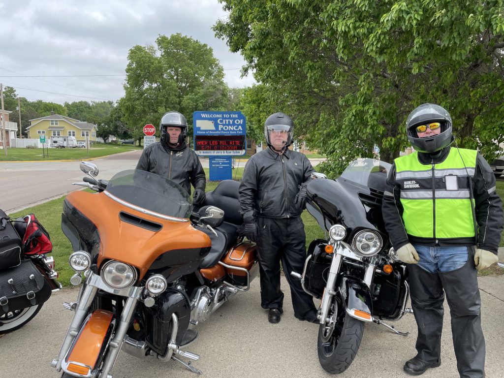
We filled with fuel at Jackson, Nebraska, then rode north on Highway 12 to Ponca. This is a very hilly area on the far northeast corner of Nebraska. The border is defined by the Missouri River, hence “the curve”.
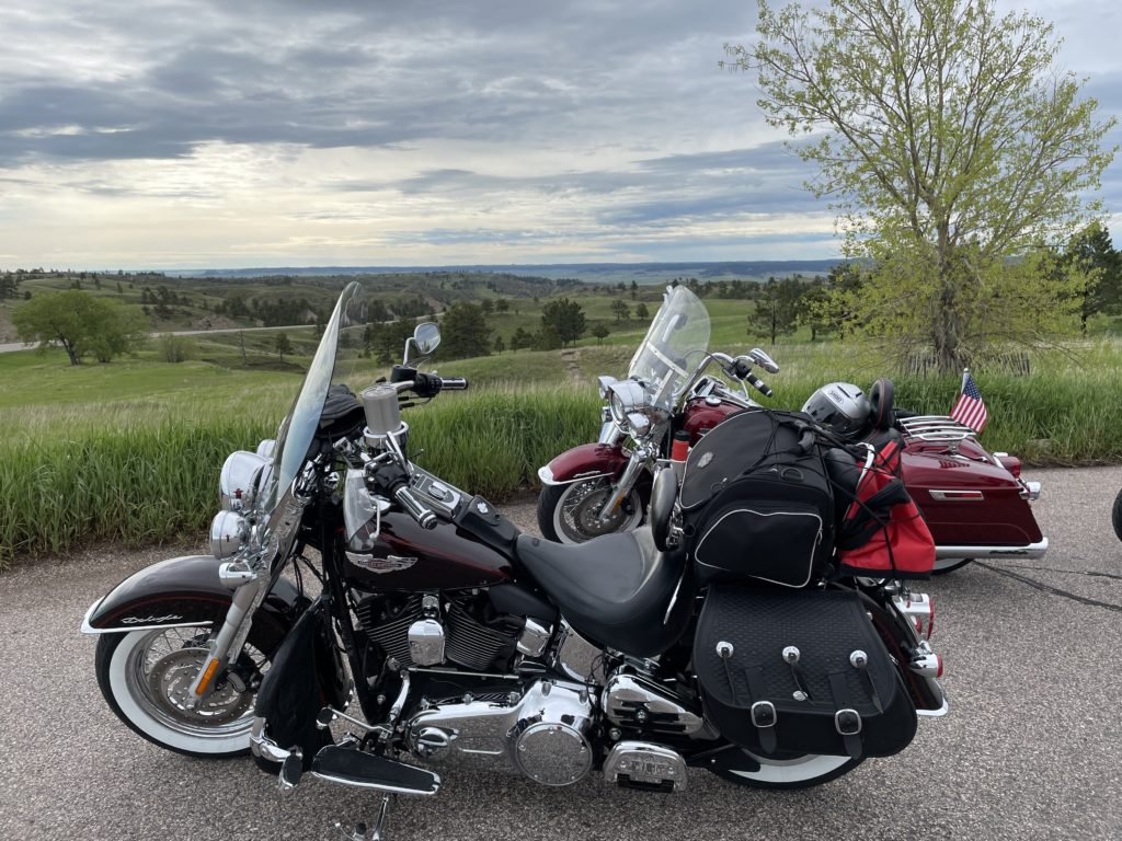
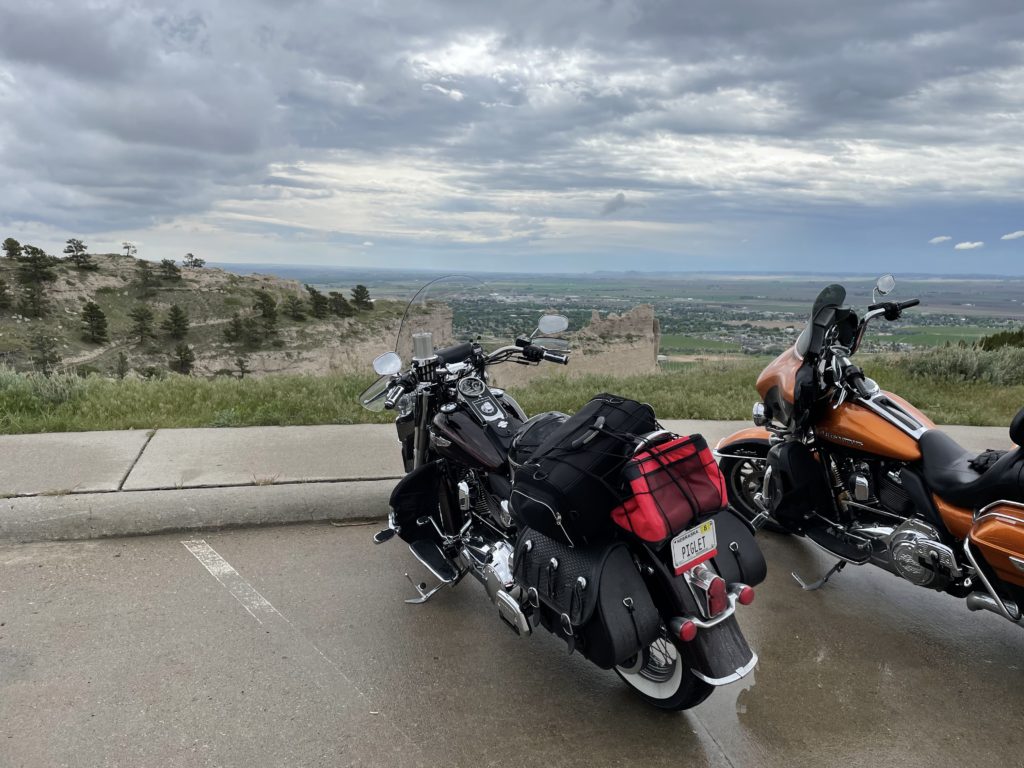
Frontier Harley Owners Club rules dictate that we take a photo of ourselves in front of signs or landmarks to prove that we made each stop in the ride. This is our first at the curve.
Ponca has a long history as a river town. As we rode further along Highway 12, we encountered more hills and lovely farm scenery. Soon, the terrain turned a little more natural and we began to see signs informing us that this was “The outlaw highway”. Apparently some of the old west outlaw gangs traveled this route to avoid the law.
We soon found ourselves in the valley of the Niobrara River, which has been designated as a national scenic byway. It did not disappoint. We went through pine wooded canyons and flat scenic wetlands. I could ride this road for a long time.
5 Corners and a Curve Ride Part 3
We are riding Nebraska Highway 12 along the Niobrara and Missouri River. It is over very hilly terrain, much of which is not highly cultivated or developed. The road is a very interesting motorcycle ride, as it twists and turns and goes up and down. There are a few small towns on the route. Many buildings are abandoned and in disrepair. There are a lot of auto repair shops and general stores. The cars of the 30’s, 40’s and 50’s took constant attention and repair. Auto service was needed frequently and vitally needed.
We descend on to a very wide wetlands area. It is totally flat and very wet. Cat tails and reeds are flourishing in abundance. Red wing black birds are everywhere. Herons are poised in the water, watching for their next snack.
A few raised one lane dirt or gravel trails are the only signs of man’s intrusion into this nature reserve. Mile after beautiful mile entrance us as we ride. A motorcycle allows full vision from side to side. We can see the edges of the roadway and beyond with clarity. The body of a car will never let the occupants see this much. We are drinking it in.
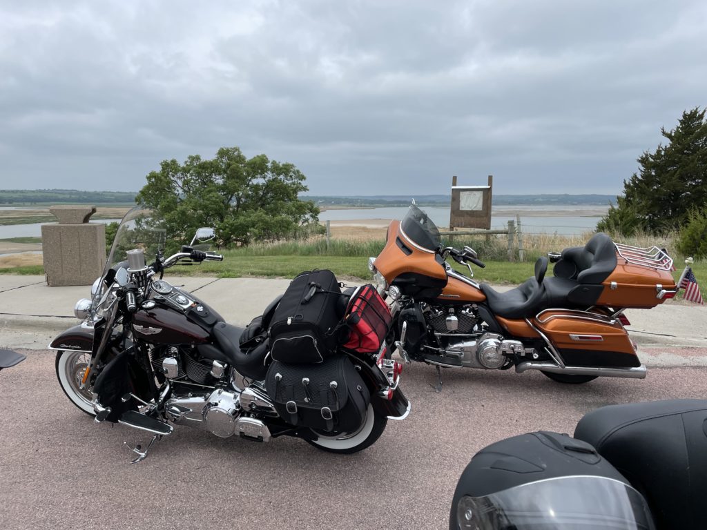
We turn off to the right to take an elevated road leading to Standing Bear Bridge over the Missouri River. We will go from the low wetlands to a bluff high above the river on the opposite bank. We pull into a scenic overlook and park the bikes.

This is the view of the Missouri that Standing Bear and Lewis and Clark saw. Further downstream, the Corp of Engineers destroyed this version of the river when they channelized it for barge traffic. What we see are many channels of running water with islands and sand bars which make ideal habitat for wildlife.
It’s easy to imagine this area with plentiful game and edible plants in the past. This would be heaven for Native Americans. We take in the sights and mount our bikes to leave. We ride back across the bridge and continue our journey. The sky is darkening and the threat of rain is imminent.

Put this on your bucket list, Nebraska Highway 12, along the northwest border from Ponca to Valentine. Our lunch stop was in Spencer at the local cafe. It was a modern metal building, with great food and pleasant surroundings.
5 Corners and a Curve Ride, Part 4
Rain appeared imminent as we rode. As an experienced rider, I knew the only way to avoid rain is to stop and put on your rain gear. This can be difficult and time consuming to get on over riding boots and jackets. As we were working to get in on, it started sprinkling.
We stopped for lunch and met a Man From Mars.
After lunch, we continued our ride, which left the river and took us over rolling hills and more lovely landscapes. We descended again down into a valley and a breathtaking river vista opened up before us. The river canyon opened up to the sandhill prairie. This was one of the reasons I had selected Highway 12. This is just as the road comes into Valentine, Nebraska, our afternoon fuel stop.
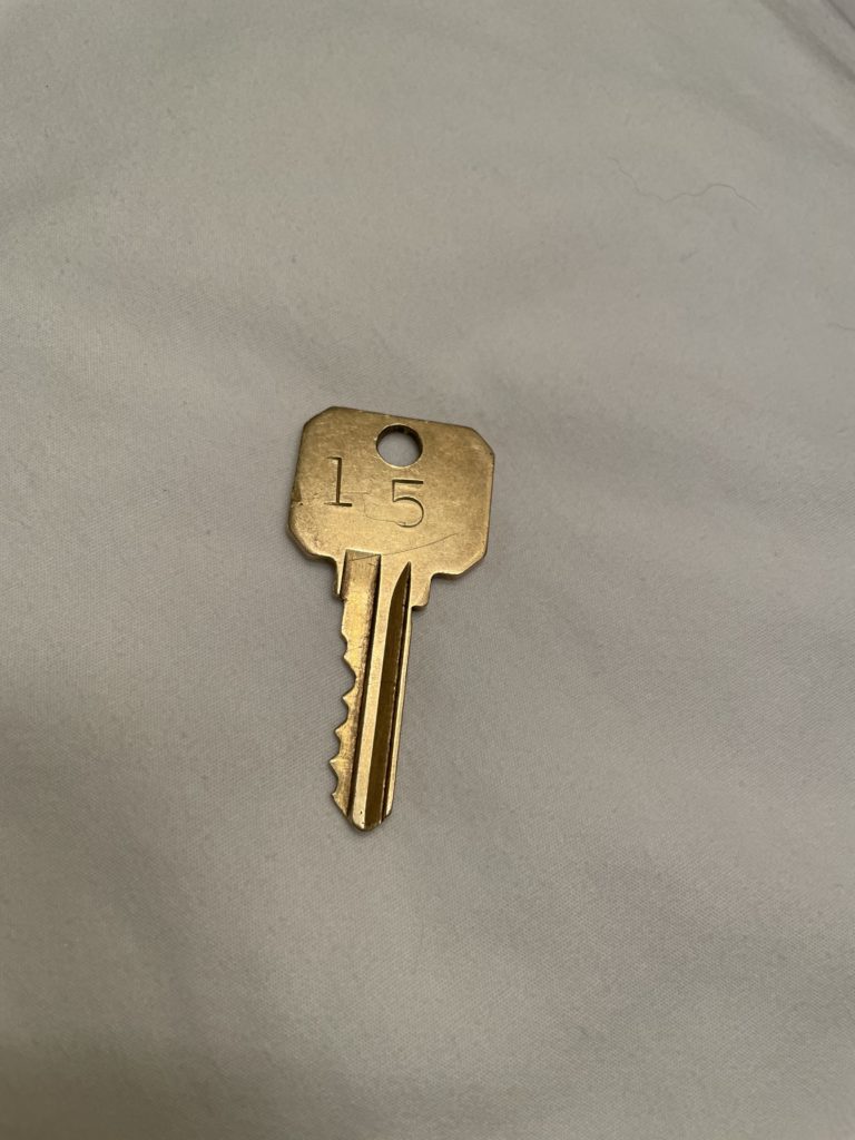
We rested, drank water and shed our rain gear. The ride into Chadron was uneventful and we arrived at the Westerner Motel. It’s been a long time since I had a room key like this, but this is very remote small town Nebraska. We had logged 515 miles for the day.
Pre-ride briefing at 7, kickstands up (KSU) at 7:30. Off we rode on Highway 20. We are near the middle of nowhere in the sandhills of Nebraska. There is hardly any traffic. The sky is clear and the sunrise delights us. We take the turnoff that will take us through Fort Robinson.
We take another scenic turn off for a 12 mile ride through “Sunny Canyon”. Great little one lane road. As I come over a hill, I screech to a halt at the sight of the largest bison the world has ever seen. This huge beast is standing right in the roadway ahead. He turns and looks at me and I look at him. My bike is in gear and my hand is holding the clutch lever. I am frozen in place.
Bison have a brain the size of a walnut and they do 2 things very well: stand in place or run over objects in their path. They are extremely unpredictable. Off to the right of the road is a whole herd of them, including some darling little calves. None of them show any reaction to us. Finally, big daddy turns and saunters quietly off the road and up the hill a ways. Seeing my opening, I engage my bike slowly and creep along the roadway, doing my best imitation of an invisible rider. We are all allowed to pass safely.
Sorry for no photos, but both hands were occupied. 🙂 We rode through the pretty little valley and back to the main road. We pulled off for a scenic overlook. When people tell you that Nebraska is flat, they’ve never been off Interstate 80 and the Platte River valley. We had a lovely view.
5 corners and a curve ride, Part 5
We covered 515 miles to get to Chadron, where we stayed for the night. On Day 2, we left for Corner 1 in the very far NW corner of Nebraska at Harrison. We will be 118 miles with no services, no gas stations, no gummy bears. We ride west in the cool morning air across pure, untouched rolling Sandhills and reach Harrison, pop. 251.

Just on the other side of this sign is another, which announces, “Harrison, next 5 exits”. We turn south and ride through town, seeing a bar and a bank. Yup, it’s a town. From this point on, we are in the purest prairie that exists. The road was constructed using the least intrusion possible and there are only small barbed wire fences to keep cattle off the road. This land has been in the families that have owned it for a very long time and they are quite scientific in their stewardship of it. There are no chemicals applied and the turf is unbroken.
The Nebraska Sandhills are left over from an inland sea. The grass covering is quite fragile. Once broken, wind and water quickly reclaim the patches of sand. Occasionally, what appears to be a sand trap just like on a golf course can be seen. Dished out of the turf, this is where the wind blows away the sand. These are called “blowouts” and they threaten the landscape. This is the reason the roadway is pretty much asphalt laid on the ground, nothing more.

The number of cattle the land can support is carefully monitored to avoid over-grazing. Science has demonstrated that there are nutrients in this grass that are unique to this area. The cattle eating this grass produce the most natural, tender and flavorful beef in the world. Known as “I-80 Beef”, it is highly prized in Japan and the finest restaurants in the United States. These steaks can literally be cut with a fork. Yes, really. The juice cannot all be sopped up with the bites, leaving a slight puddle of juice on the plate when the meal is done. But, I digress.
We are rolling along this pristine land enjoying the sights. There are no signs, no intersecting roads, no traffic lights, no traffic. We are riding during the Memorial Day Weekend and there is literally no traffic. We will see another vehicle only about every 20 miles. My mind goes back to another era, where large herds of buffalo roamed this land. The grass nurtures the beasts and they fertilize the grass. Perfect nature. The air is so clean that you can smell water. The largest underground aquafer in the world lies buried under this land. The Ogalalla covers almost all of Nebraska and other states. Water is abundant and there are ponds all over.
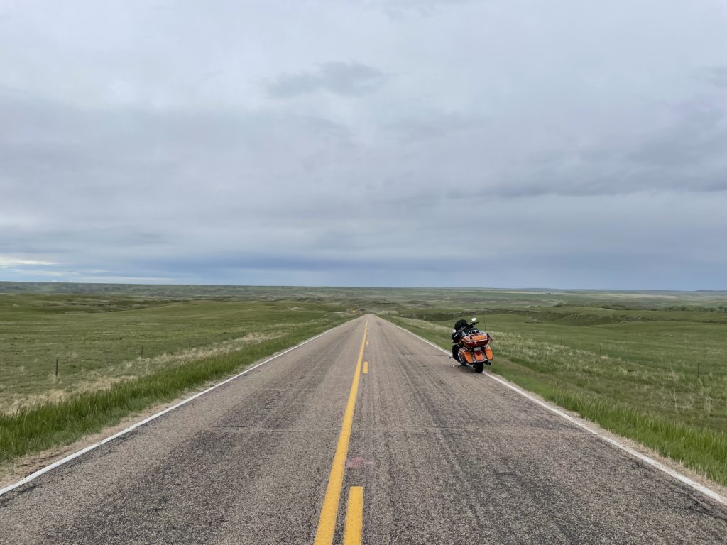
Our powerful Open Road bikes sing their song as we drink in these sights. Soon, we see antelope and the song “Home on the Range” plays in my head. Thanks for that ear worm. ![]() We stop our bikes right on the road to take pictures of the lovely valley unfolding before us. Study the road ahead and it can be seen to seemingly disappear ahead and below, only to resurface miles ahead on the right. There is no sound. Anyone who wants to get away can do so easily out here. I love Nebraska. As we continue our travel, we scare a large wolf, who comes shooting out of nowhere crossing our path on our right. He is moving fast and goes right under the barbed wire to the left never breaking stride. He is large and as fast as any canine I’ve ever seen. 118 miles is over sooner than any of us wants. More corners await.
We stop our bikes right on the road to take pictures of the lovely valley unfolding before us. Study the road ahead and it can be seen to seemingly disappear ahead and below, only to resurface miles ahead on the right. There is no sound. Anyone who wants to get away can do so easily out here. I love Nebraska. As we continue our travel, we scare a large wolf, who comes shooting out of nowhere crossing our path on our right. He is moving fast and goes right under the barbed wire to the left never breaking stride. He is large and as fast as any canine I’ve ever seen. 118 miles is over sooner than any of us wants. More corners await.
Part 6
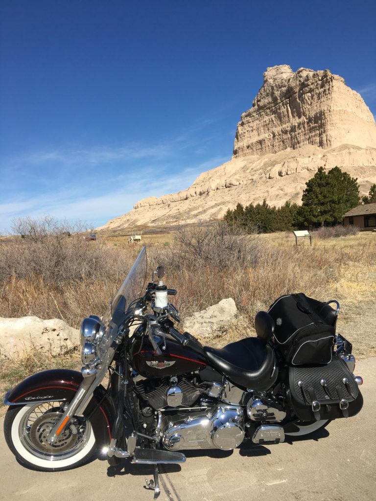
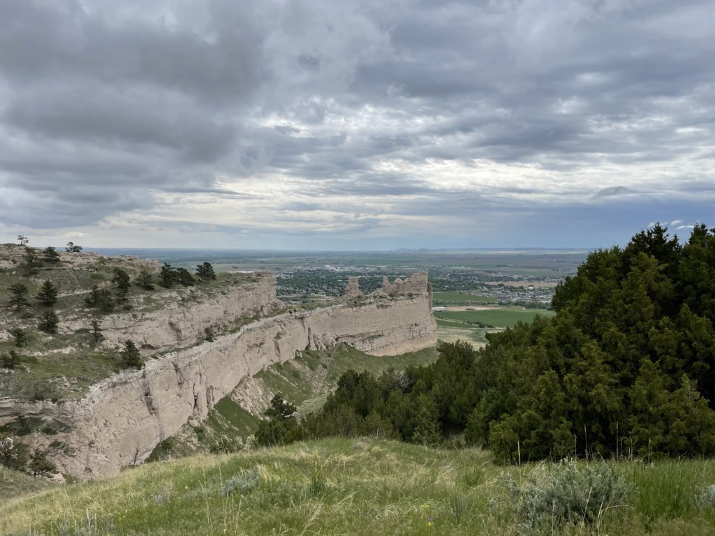
We ride off the prairie and into the town of Scottsbluff, Nebraska. On the southern edge of town is a huge rock formation rising above the plains, visible for many miles. Scottsbluff National Monument sits right on the Oregon Trail. Covered wagons can be seen in the background of one of the photos. These have been set up to illustrate the journey of the pioneers who passed here. There are still ruts visible that were carved into the soil by the many wagons headed west to Oregon for the promise of a new life. A miracle of engineering provides a road taking vehicles to the top. The view is stunning. The road is steep and goes through several tunnels. Motorcycles have a clutch and the last thing you want to do is stop on the way up. Oh, an guard rails apparently were deemed to interfere with the view. ![]() Scenery can be seen on several sides from the top. If you find yourself anywhere near Scottsbluff, Nebraska, this is definitely worth the stop. There is also a building at the base with more artifacts and information of the pioneer migration.
Scenery can be seen on several sides from the top. If you find yourself anywhere near Scottsbluff, Nebraska, this is definitely worth the stop. There is also a building at the base with more artifacts and information of the pioneer migration.
We saddle up and stop for gas, then continue our ride south to arrive at the 2nd corner, Bushnell. We pass through Kimball and a whole line of artifacts of the past. Car dealerships, mechanic shops, motels and other shuttered and abandoned buildings are signs of progress. Once hives of activity on the major U.S. highway, they were rendered obsolete by Interstate 80. The road follows the scenic North Platte river, which carries snow melt out of Wyoming. From Bushnell, we head a few miles south and get on Interstate 80. Our large powerful engines bellow their song as we roll on the throttles to merge into the 80 mph traffic. The bikes accelerate effortlessly and we merge easily. We are all expert level riders and our formation is straight and precise. One of the jobs of the Road Captain (RC) is to provide signals to direct the group. Turn left or right, slow down, speed up, form a single line or back to a double line are a few of the signals. Each biker in turn echos the sign. This provides feedback to the RC that the biker understands the signal and also transmits the signal all the way back to the end of the line. The last biker in the group is also an RC and is called “the sweep”. The sweeps job is to assist with lane changes and to provide help in the event a biker has trouble. The biker code is strict: No biker is EVER left behind or alone. It is not safe for the group to pull over in traffic, so they continue on if a biker drops off. Another rider takes over as the sweep in this event. We stop at Corner 3 in Big Springs, then ride through heavy rain in Colorado to Corner 4 in Haigler. Destination for the night is McCook, Nebraska. We are cold, wet from the rain and tired. We’ve covered another 500 miles and are ready to stop. We are so wet that we leave a giant puddle in the lobby of the Holiday Inn when we check in. The final day is another 400 mile adventure. We are a little tired and wonder who ever thought this thing up in the first place. ![]() We ride to the final corner, number 5, in Rulo, Nebraska. Ride over, I just have to ride another 115 miles home. I’ve just done this ride twice to plan it and once to lead it. That makes over 4,000 miles of riding Nebraska. Would I ever do this again? In a heartbeat. I’d encourage any of you to do part of this, whether it’s on a bike or in a car. It is lovely.
We ride to the final corner, number 5, in Rulo, Nebraska. Ride over, I just have to ride another 115 miles home. I’ve just done this ride twice to plan it and once to lead it. That makes over 4,000 miles of riding Nebraska. Would I ever do this again? In a heartbeat. I’d encourage any of you to do part of this, whether it’s on a bike or in a car. It is lovely.
How wonderful, I bet you all had a great time. Love the gas pump sign… we once stayed at an RV park (private) that only accepted either cash or check… no credit cards… it was near Athens, Ala. and quiet and friendly people ran the place.
Would love to ride this sometime. I was wondering if there might be a map with the route?
If you read the story, I’ve explained the towns in each corner and the highways we used. It’s easy and there are choices.