The Bucket List, Part 1, the Oregon Trail
As we travel through life, we see photos or hear stories of places that we think we might like to see “someday”. Thus comes the list of things we feel compelled to do before we “kick the bucket”, hence, the Bucket List.
A book written by a person who worked with many old people focused on their biggest regrets in their lives. Their number one regret was NOT things they did. Rather, it was things they DIDN’T DO.
I recently checked off a number of things on my own Bucket List when I rode my motorcycle 4,400 miles in 10 days. Rather than bore you with countless vacation photos, I decided to present some of the bucket list experiences that I checked off.
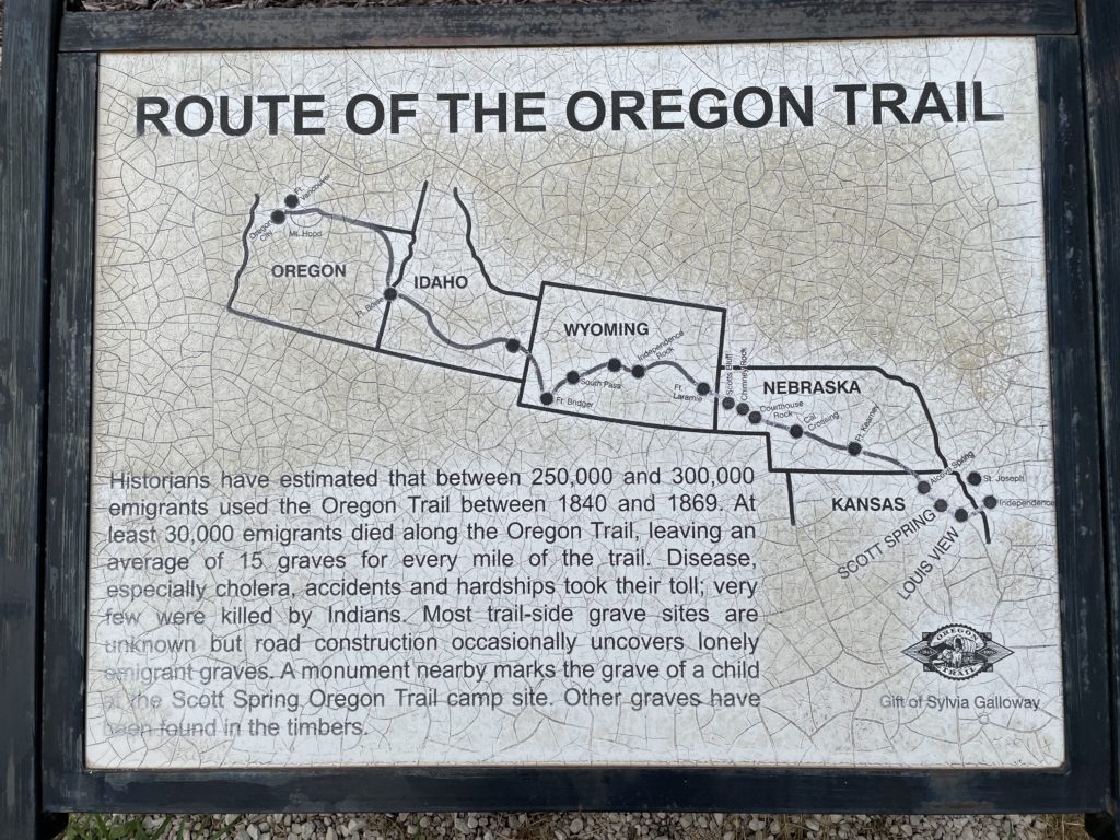
I’ve researched and visited a lot of the sites on the Oregon Trail for many years. This year, I rode my motorcycle from Westmoreland, Kansas and followed the Oregon Trail all the way to Oregon. The original trip was 2,000 miles for the pioneers, I rode 1,500 miles.
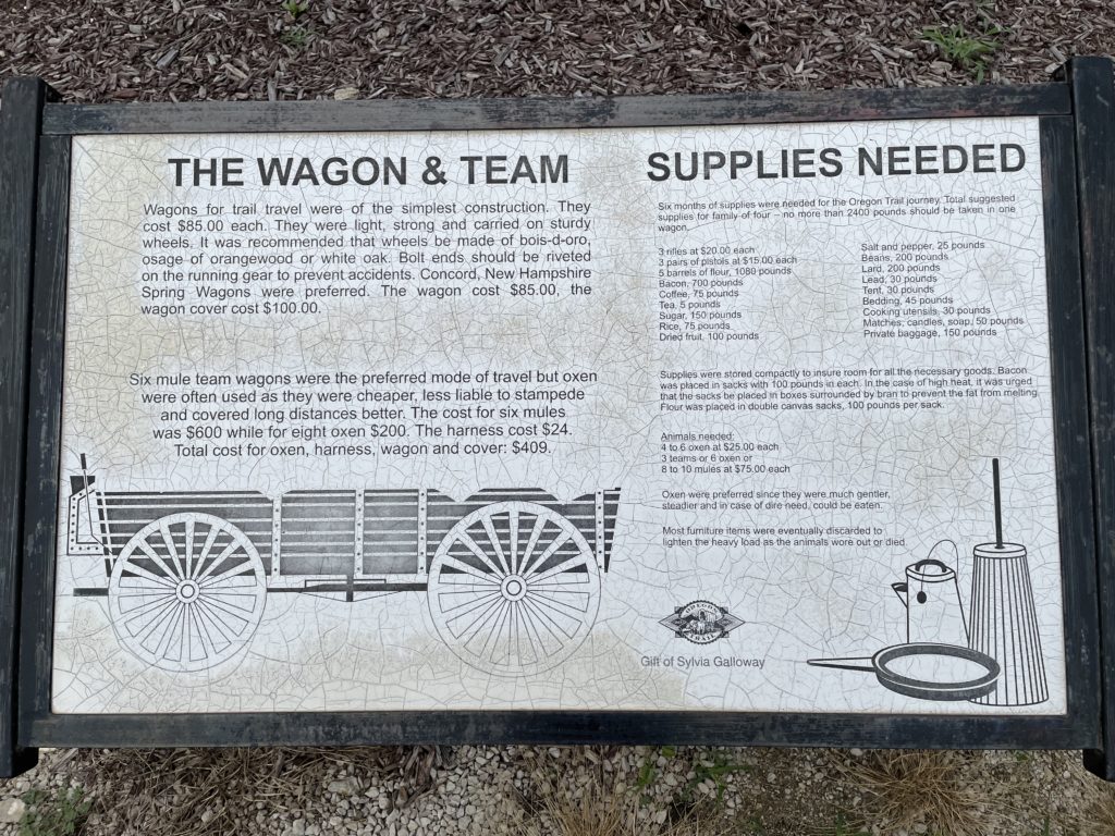
The wagon, the canvas cover, the team of oxen or donkeys to pull it and 6 months of supplies was roughly the equivalent of a year and a half of earnings. It’s difficult for me to imagine how bad things must have been for these people to risk 18 months of savings to set out on a dangerous journey. How dangerous? There were roughly 15 deaths per mile over the 40 year span of the covered wagon era.
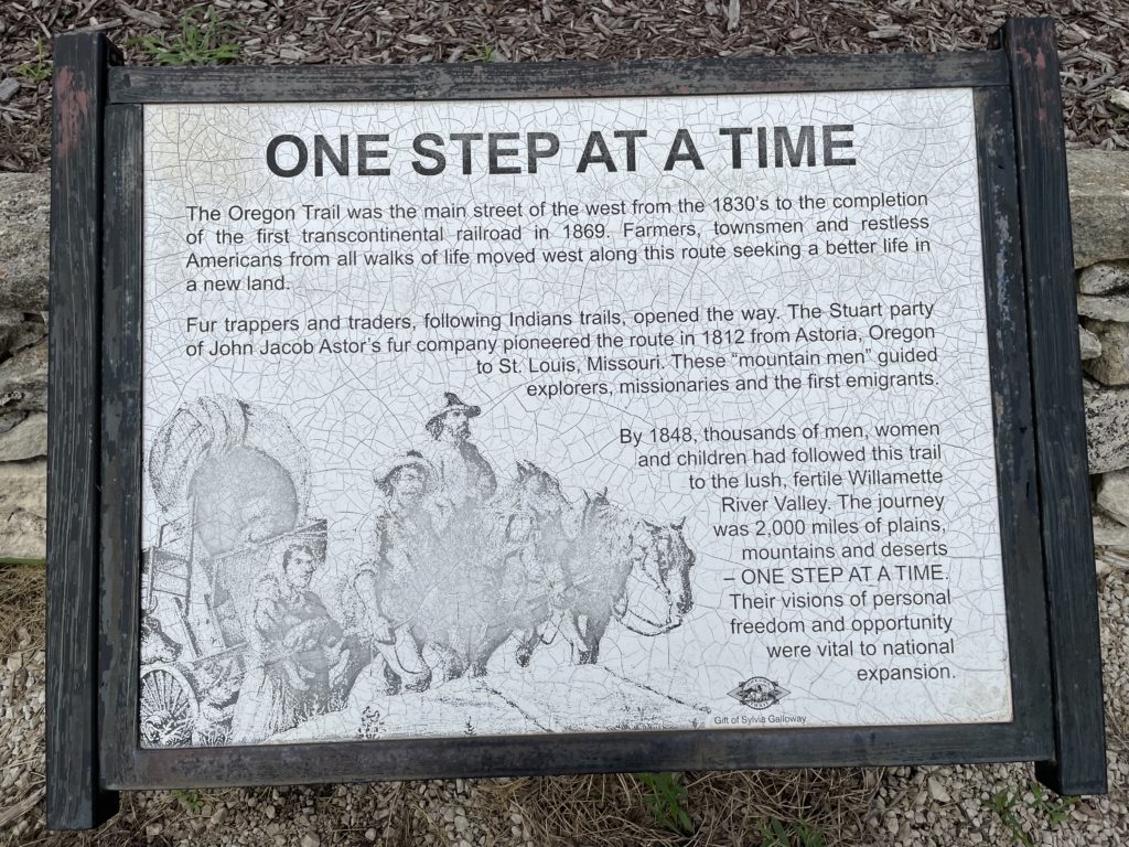
This involved walking approximately 13 miles every day, with Sunday off for rest. The trip took 6 months. The penalty for being late involved perishing in a snow storm.
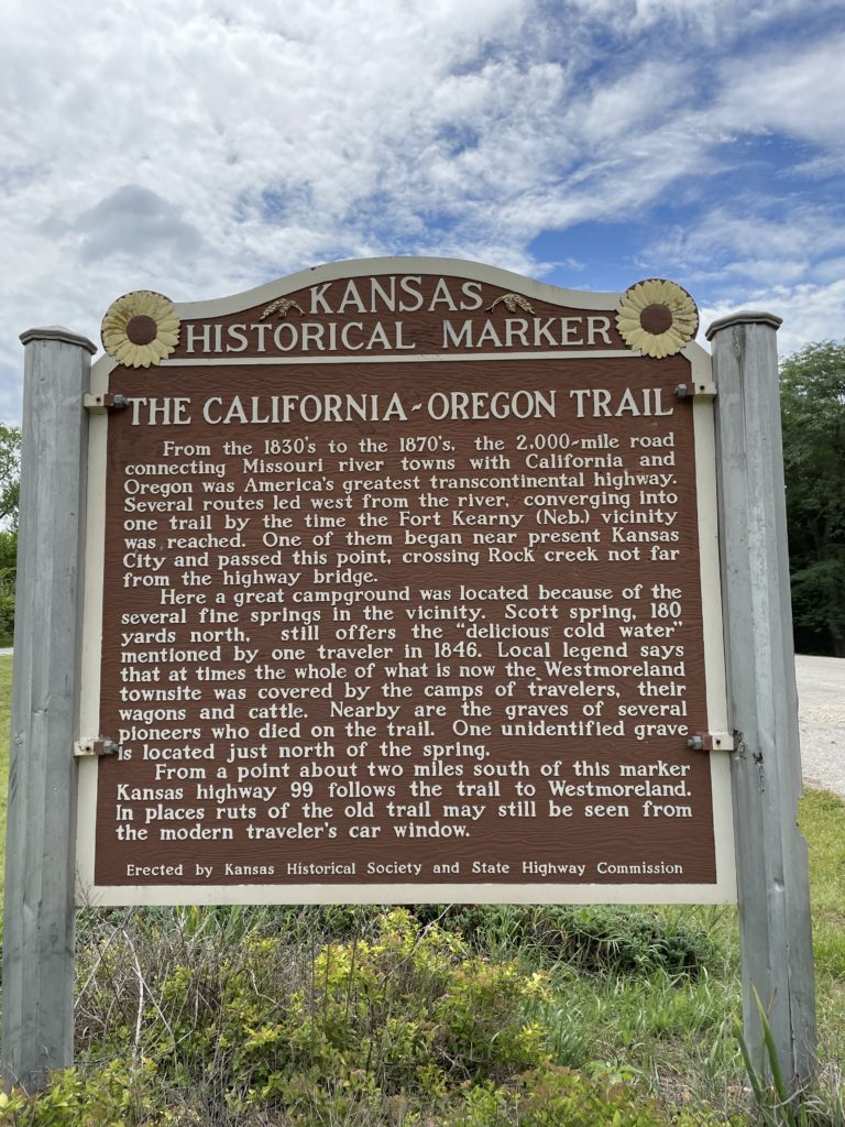
My plan was to ride about 500 miles per day. I’d set aside a few short days for sight seeing. I started by visiting this site of these photographs just south of Westmoreland, Kansas on Highway 99 south and a little east of Marysville, Kansas.
I took off on my Honda Gold Wing, which had navigation, cruise control, heated grips, heated seat, satellite radio, weather, Honda Anti-Lock brakes and tire pressure monitoring system. She loves to run.
I followed Interstate 80 along the Platte River valley. The land is flat from hundreds of thousands of years of the Platte flooding from snow melt every spring. Travelers complain that Nebraska is flat for this reason. Travel 5 miles in either direction from the river and the myth is busted by gently rolling hills.
I set the cruise control on 80 and rolled along. The road crossed the Platte many times and I had visions of pioneers traveling and camping by this river. Since they had no knowledge of bacteria or sanitation, many diseases sickened travelers and claimed lives.
At Ash Hollow cemetery, near Lewellen, Nebraska, is a marker where children were buried. Their lives were taken by cholera, as were many other travelers. The Oregon Trail follows the North Platte River and diverges from I-80. I stay on the road to Laramie, Wyoming.
The descent down a canyon from Cheyenne, WY to Laramie is memorable in my mind from the Women’s Freedom Ride (WFR) of 2017, my first. The road was under construction and 35 of us women riders braved serious buffeting winds from all directions. There were concrete barriers to our left and rocky ditches to our right. We were riding in formation at 75 miles an hour.
This is the stuff that makes WFR riders some of the best there are. Suck it up and ride, cupcake, you’ll come out of this a much better rider.
On this day, with that experience under my belt, I rode with confidence and had a
wonderful time. I stopped for the night in Laramie, ending day one.
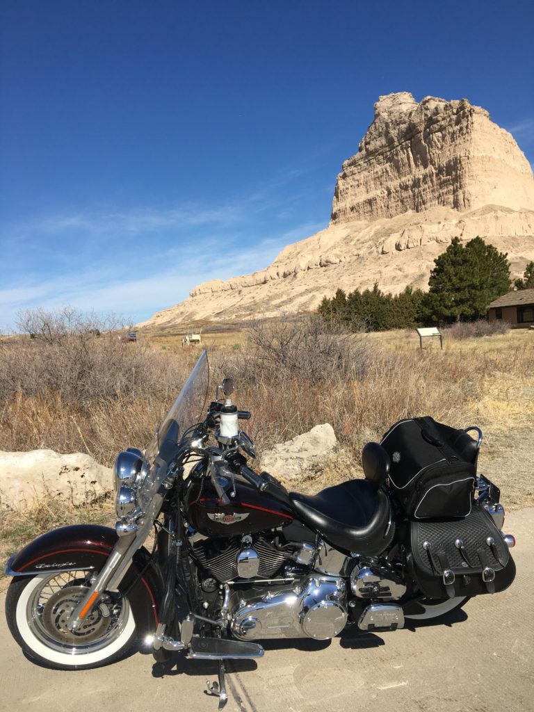
Part 2. On the first day, I had passed some important pioneer landmarks. The first was Chimney Rock, a tall spire visible for miles. This signaled the end of flat land travel for the covered wagons. The easy life was about to be over. Next was the large rock of Scottsbluff National Monument. Deep ruts from the original Oregon Trail are still visible. They display some wagons there, seen in the background of the photo.
The next day dawns clear and bright. I’ve just crossed into the Mountain Time Zone and gained an hour. I eat breakfast at the motel, load the bike and head west. Laramie is in a valley and it’s all uphill from here. The altitude and incline mean nothing to my Goldwing. She is happy to run 80 mph using the cruise control and never loses a single mile per hour even on steep Rocky Mountain inclines.
Wide sweeping curves are the stuff of dreams for a motorcyclist. I take them in and enjoy every degree of lean at high speed. Honda built this bike using technology learned from racing and being able to use just a little of it brings broad grins of happiness.
In what seems no time at all, I’ve almost crossed Wyoming. Near mile marker 30, I exit on to Highway 30 and ride across high plains on lightly traveled 2 lane highway. I enjoy the sights and the small towns. Soon, I find signage indicating I’m back on the route of the Oregon Trail. This is not bare mountain terrain, it is plains that are better suited to a covered wagon. I marvel at the fortitude of the pioneers and wonder if they had any idea how difficult this trip would be when they left home.
I get on to Interstate 15 for a short distance to Idaho Falls. I appear to have passed the Continental Divide and the land now slopes downward. I can envision the Pioneer travelers whooping with excitement and running at times with anticipation of the hard part being over. Almost there, would come cries of joy. I’m not certain that they really understood they still had 800 miles to go.
I ride on to Pocatello, Idaho, then pick up Interstate 84. This takes me to my stop for the night at Burley. I’ve ridden 533 miles today and arrive early at the motel. I feel good and relaxed and have covered 1,000 miles in two days. Once again, I arrive early and have time to eat a good meal and relax. –
Part 3. The morning was 38 degrees. Cold is not unusual in the mountains. Adapting to variations in temperature make motorcycle trips more of a challenge when packing gear. I put on heated gloves, fired up the heated grips, seat and foot heaters. I didn’t bring heated coats, as that wasn’t necessary. Packing for a bike trip takes planning and this was the coldest ride of the trip. The weather warmed up in a few hours and I was not uncomfortable. By 9am I was shedding some gear and feeling the warmth of the sun on a clear day.
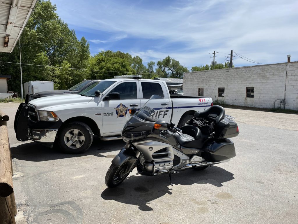
I was stopped by the Police in Montpelier! It’s very rare that I eat fast food and it can be difficult to eat right when traveling. Dad taught me some great things and one of the best is how to find good food when the choices are all small town cafes. He would never eat at any place that didn’t have a crowd at meal time. If no one was there, he said the food was usually the reason. He would ALWAYS eat when there were police cars in the parking lot. Dad said that law enforcement is on the road every day and they know where the good food is.
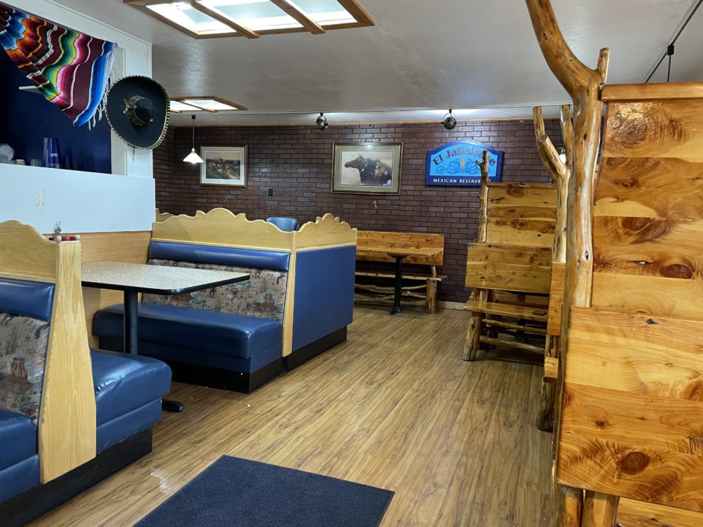
As I’m cruising through Montpelier, Idaho, I spot a Sheriff’s car in the parking lot of a Mexican restaurant. I parked next to it, so I was stopped by the police. J The place was beautiful inside and it gave the impression that the whole family was working there. The food was wonderful and I enjoyed the break.
Back on the bike, I passed the Snake River, near the place where Evel Knievel attempted his jump of the Snake River Gorge. The rocks are rugged and the river has carved a deep home. I would be seeing this river on several occasions as I traveled. I had now crossed my final state border and entered Oregon. Woohoo, the end was in sight.
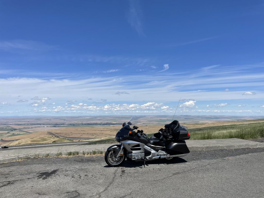
The rest of this trip would be Interstate 84, which followed the Oregon Trail. I rode across high plains and then ascended yet more mountains. Near Pendleton there was a scenic turn off and I pulled in. Photo ops are difficult when riding a motorcycle, as your gloves prevent use of a camera when moving and it’s not safe to park on the shoulder. I found a glorious vista and took time to soak it all in.
Surely, this sight would have the pioneers cheering and clapping as they surveyed their new homeland. But, like a cat who has climbed a tree, they have to figure a way to get the heavy wagons back down off the peak. It must have been a harrowing experience. Thankfully, they would have eaten much of the food they brought, making the wagons lighter as they traveled.
As I rode on, I noticed a reservoir to my right. It was long and blue. It seemed to go quite a ways, then I realized that this was no man-made lake. It was the Columbia River, deep and still. The further I rode, the deeper the channel became. Soon, I found myself in the scenic Columbia River Gorge. The road was carved into the cliffs of the south side of the river and a road could be seen on the other side.
There were very few exits on the Interstate and there were some marinas. At this point, the current became more prominent and rocks and rapids appeared. Boats were navigating between them and there were fisherman trying their skill.
As the miles rolled on, the river seemed to get more calm again and it widened out. A large bridge made its way over the river and then I saw a large dam. This was for hydroelectric power generation and there were heavy power lines emerging from the canyon in several directions.
Soon, I saw another dam and I had arrived at my final destination of The Dalles, Oregon. The trip was 3 days and 1500 miles. This had been a scenic and historic trip. Check one off the bucket list.
Hum… part 2 picture is a Harley, the other pics the Gold Wing… did you do this ride more than once? Sounds like you had a great time. Thanks for sharing your adventures.
I’ve studied the Oregon Trail route for a number of years. The photo with the Harley was a few years ago. Nice catch.